Image

Geography Department
Geography is concerned with the interactions between man and the environment, and the processes that influence these interactions, such as urbanization, agriculture, mobility, trade, globalization and climate change. A science of action, geography offers a framework for reflection and tools to guide decision-makers towards sustainable solutions, thus promoting the harmonious development of societies and the preservation of the environment.
.
Geography is a committed science. It explores, deciphers and improves the organization of our environment, thus contributing to a better developed and more sustainable planet.
Geographers, with their unique perspective, examine the complex links between man and his habitat. They go beyond the simple questions of "where" and "at what scale", looking at the reasons for "why here rather than elsewhere?" and ways of optimizing the management of space.
At the crossroads of the natural and social sciences, geography occupies a central position, proposing comprehensive and thoughtful solutions to questions of location. It does not content itself with theories, but implements modern tools such as computerized cartography, geographic information systems, remote sensing, satellite imagery and data analysis.
That's not all: geography goes beyond theory by putting these tools at the service of spatial planning, technical cooperation and development aid policies, demonstrating its commitment to humanity.
Geographers observe and analyze territories, organizations, individuals and ecosystems in order to understand them, to grasp their complexity and then to propose solutions.
Discover the geographer's professions in our newsroom article...
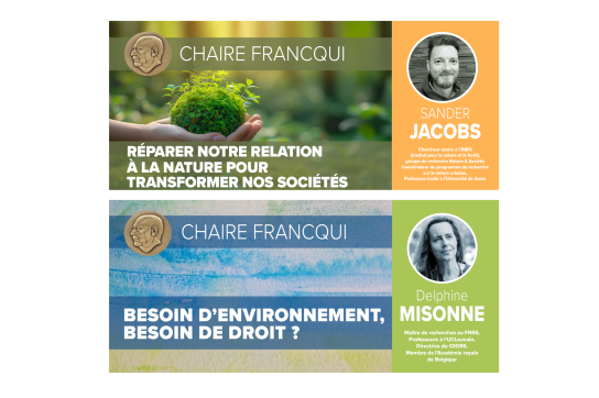
The University of Namur is soon to offer two inaugural lessons for two Francqui Chairs, one in the Faculty of Science and the other in the Faculty of Law. Open to all, the inaugural lectures will be followed by a local drink. These events are free, upon registration.

The biodiversity crisis isn't just destroying nature: it's also threatening our societies, our well-being and our survival. Based on the scientific assessments and findings of the IPBES (Intergovernmental Science-Policy Platform on Biodiversity and Ecosystem Services), this Francqui Chair will explore our toxic relationship with nature, the global failure to protect it, and the multiple values of living things.
Speaker: Sander Jacobs, Senior Researcher at INBO (Institute for Nature and Forestry), Nature & Society research group, Coordinator of the Urban Nature research program and Visiting Professor at Ghent University.
19/11/2025 - Inaugural lecture | Biodiversity crisis: causes, consequences, and how (not) to get out of it.
This Francqui Chair offers a fresh look at the advances but also the tensions that today characterize the way the law organizes society's relationship with the environment. If the ambition to protect the environment has indeed become a legal issue, how are its essential mainsprings evolving, whether in climate matters, in the relationship to human health, or in the status accorded to nature?
The organization of this Chair is fully integrated into the Law School's Fil Rouge 2025-2026 dedicated to this substratum essential to life that is the environment, nature, our earth: "Réenchanter la terre".
Orator: Delphine Misonne, Senior Research Fellow FNRS, Professor at UCLouvain, Director of CEDRE and member of the Royal Academy of Belgium.
27/11/2025 - Inaugural Lesson I Protecting the environment beyond politics
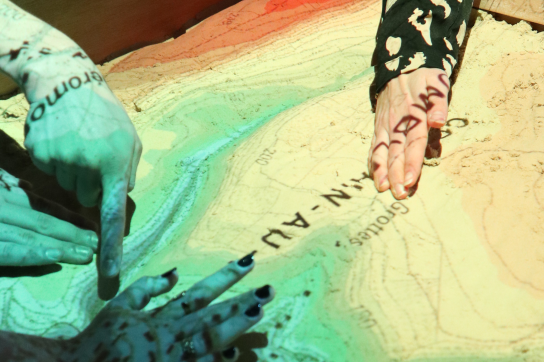
How does a river work? How do river overflows occur? What can be done to protect our territories from these risks? At UNamur, geography students followed an innovative teaching activity, using a 3D augmented reality sandbox, to learn about this issue. What are the aims of this tool? Simulate and analyze natural phenomena. A unique and immersive experience to better understand environmental dynamics and climate risks, carried out in collaboration with the non-profit organization Contrat de Rivière Ourthe.
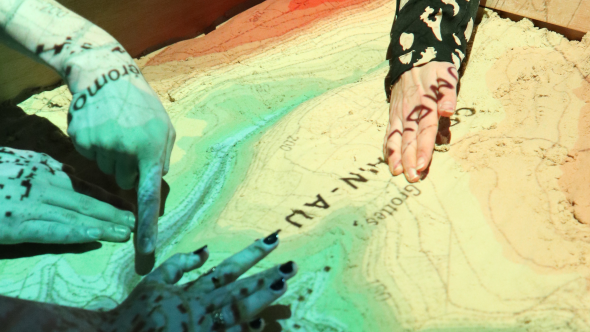
In early October, it was with their hands in the sand that Bac 2 and Bac 3 students from UNamur's Geography Department were able to gain a very concrete understanding of the flooding mechanism. "This activity was organized in partnership with the asbl Contrat de Rivière Ourthe," explains Sébastien Dujardin, teacher-researcher in the Geography Department. "Our students had the opportunity to use a 3D augmented reality sandbox, developed as part of the EXACT LAB project (Exploration 3D et Adaptation aux Conséquences des Changements Climatiques sur un Territoire)", he details.
During this activity, students modeled the relief by hand and simulated virtual rainfall to observe runoff on the ground, thanks to 3D Kinect technology. Various layers of geographic information, such as topographic maps, aerial photos and runoff maps, were then projected onto the relief to further the reflection.
Students were able to explore how rivers work, concepts related to flooding (return period, amount of precipitation, hydrometry, etc.), and analyze the territorial issues most at risk (schools, homes, roads). They also discussed and tested various planning measures, such as hedge planting, the creation of stormwater basins and ditches, taking into account natural and human constraints.
"This activity was an excellent opportunity for our students to develop their risk culture, essential in the face of the growing challenges of drought and flooding," Sébastien Dujardin points out again. "The topic of flooding is more topical than ever and represents a major societal challenge. It perfectly illustrates our educational approach: observe, understand and act to better harmonize human activities with an ever-changing environment," he concludes.


Alison Castremanne student in Bac 3 Geography
"This activity highlighted the importance of participatory planning and management involving the various stakeholders in the territory to deal with issues such as flooding. For example, we found that anti-flooding practices implemented upstream can have a significant impact on flows downstream. Modeling through this activity has enabled us to visualize in concrete terms the flows and preventive practices adapted to the geographical context (topography, location of villages in relation to slopes, budgetary constraints, etc.). What I particularly appreciate about UNamur is the dynamism of the training, which combines enriching practical activities (field days, workshops, group work) with high-quality theoretical teaching. What's more, the proximity and commitment of the professors and assistants offer attentive and enriching support for students."
Léo Raymond student in BAC3 geography
"The "sandbox" tool helped me understand that a territory is never uniform: development that is conceivable across a commune is not at all so 5 km away. From this point of view, it's very important to analyze what's around us and react accordingly to avoid too much damage."
What fascinates me about my studies in geography is the diversity of the subject we tackle. Whether it's environmental, anthropocentric or even economic, everything is tackled and this enables us to build up a very important knowledge base for the future."
Are you interested in studying geography? Find out more about our training courses!
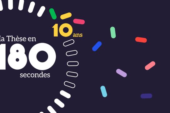
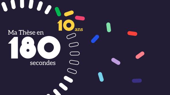
On March 24, 2024, the tenth edition of the MT180 competition, a French-language competition for the popularization of science, took place at UNamur. Two physicists and a geographer represented our university at the national final, held in Brussels on May 16.
The Confluent des Savoirs, local organizers of the event, wanted to focus on one of the societal missions of research: popularized communication to a wide audience.
Annick Castiaux, Rector of UNamur, introduced the competition with the rediscovery of a sequence from the 1998 program Matière Grise, in which she presented, in two minutes, the objective of her research in optical physics. Encouraging young researchers to learn how to communicate in lay terms, Annick Castiaux stressed the need to adapt codified scientific discourse to reduce the distance between university research and other players in society. Presented by Aline Wilmet of Confluent des Savoirs, the event was an opportunity to explore the history of the competition at UNamur and to exchange experiences with former candidates.
This year, 12 candidates took part in this local final: Manel Barkallah (computer science), Louis Rassinfosse (physics), Charline Focant (biology), Guillaume Nguyen (computer science), Yves Blanco Alvarez (biology), Alexandra Decloux (veterinary medicine), Adélie Lannoy (biology), Loris Chavée (physics), Yasmine Akaichi (computer science), Valentin Job (physics), Antoine Hubermont (computer science) and Camille Morlinghem (geography).
Their performances were enthusiastically received by the audience: 280 people gathered in the Rosalind Franklin auditorium to discover the latest in interdisciplinary research and its societal challenges. In order to prepare them optimally for the demands of the competition and those of their thesis or lecture defense, candidates benefited from training in popularized communication, the construction of a structured pitch, as well as appropriate speaking and body language.
The candidates' pitches were evaluated by a jury of professionals in the field of scientific communication and popularization: Géraldine Tran, editor-in-chief of Athena, SPW's science mag; Nathan Uyttendaele, statistician and web popularizer via his YouTube channel "Chat Sceptique"; Charlotte Benedetti, director of Pavillon (KIKK asbl) in Namur and François-Xavier Fiévez, pedagogue, didactician and improviser, Vice-Rector for Student and Social Affairs at UNamur.
The People's Choice Award went to Louis Rassinfosse for his pitch "Les nanoparticules: ces artisans des couleurs", left in photo. The second jury prize went to Loris Chavée for his pitch "Sun, film and foam .... an energy cocktail!", right in photo. The jury's first prize went to Camille Morlinghem for his pitch "Map me if you can", in the center of the photo.

The regional competition is the first step in the MT180 adventure. The three winners from Namur will represent UNamur at the national final to be held on May 16 at the Solbosch campus in Brussels. The winner will represent Belgium this autumn at the international final in Abidjan (Ivory Coast).
On May 16, 2024, we'll be celebrating 10 years of the MT180 competition at the national finals to be held on ULB's Solbosch campus in Brussels. At this event, 15 PhD students, including the 3 UNamur prizewinners, will take up the challenge of popularizing their thesis topic with clarity to captivate an uninformed audience, in 3 minutes flat!
The jury will be made up of 6 personalities from French-speaking universities, the press and the world of popular science. The winner will represent Belgium at the international competition to be held in Abidjan, Côte d'Ivoire, the week of November 18, 2024.


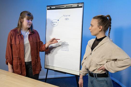
As part of the English course of the Bachelor in Science and Medicine, students are introduced to the oral popularisation of scientific concepts. This year, these future biologists, chemists, geologists/geographers or pharmacists expressed themselves in the form of videos inspired by the famous French science popularisation programme, "C'est pas sorcier". A competition to choose the best video has been launched as part of the Printemps des sciences.
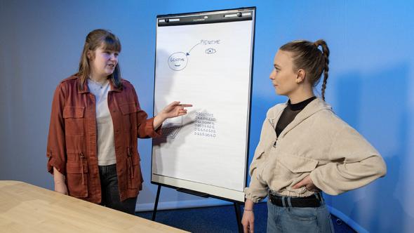
Mêler l’apprentissage de l’anglais et de la vulgarisation scientifique, tout en stimulant la créativité et l’amusement des étudiants. Tel est le savant mélange du projet « It’s not Rocket Science » développé par deux professeures d’anglais du département des langues vivantes de l’UNamur.
« ‘It’s not rocket Science’, est l’équivalent de « C’est pas sorcier », en français. Nous nous sommes inspirées de cette célèbre émission pour lancer ce projet destiné à nos étudiants de première année inscrits en biologie, chimie, médecine, géologie/géographie et pharmacie qui doivent se former à l’anglais scientifique. Cette année, nous leur avons donc demandé de former un binôme et d’expliquer un concept scientifique abordé dans un de leurs cours. Ils devaient le vulgariser en 3 minutes sous forme d’une capsule vidéo didactique, à destination des élèves de l’enseignement secondaire, expliquent Natassia Schutz et Aude Hansel, professeures d’anglais à l’UNamur. En utilisant leur smartphone, les étudiants ont ainsi créé près de 150 vidéos.
Une petite dizaine d’entre elles, soit les plus convaincantes, sont aujourd’hui sélectionnées pour participer à un concours qui se tiendra pendant la semaine du Printemps des Sciences (20 au 26 mars), où des élèves du secondaire seront amenés à voter pour la meilleure vidéo !
Les binômes sélectionnés pour le concours ont eu la chance de pouvoir profiter d’un accompagnement « pro », via un coaching dispensé par le Confluent des Savoirs – la cellule de médiation scientifique de l’UNamur – ainsi que d’une captation réalisée par le studio audio-visuel de l’université.
« L’objectif de cet exercice est triple : offrir un aperçu de ce qu’on fait à l’université, donner envie aux jeunes d’étudier les sciences et permettre aux étudiants d’aborder l’anglais scientifique d’une manière très concrète », soulignent Natassia Schutz et Aude Hansel.

